Jupiter Map - Annotated
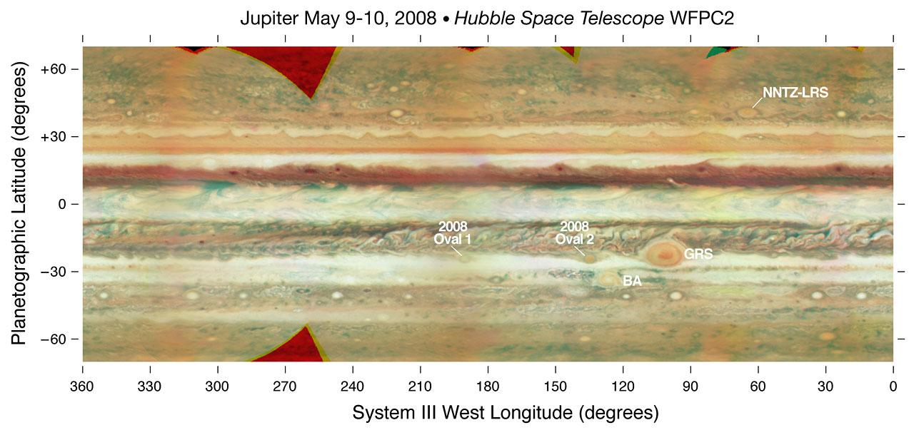
False colour cylindrical map of Jupiter, constructed from a set of images of the planet obtained with the WFPC2 on the Hubble Space Telescope. Individual frames were obtained on 9 May and 10 May, 2008. The images were deprojected and mosaiced together. The map shows latitudes between +/-70 deg. The resolution is a quarter degree in latitude and longitude. Images were combined at 673, 502, and 410 nm, as red, green, and blue colours.
Credit:NASA, ESA and M. Wong and I. de Pater (University of California, Berkeley)
About the Image
About the Object
| Name: | Jupiter |
|---|---|
| Type: | Solar System : Planet : Type : Gas Giant |
| Category: | Solar System |
Colours & filters
| Band | Wavelength | Telescope |
|---|---|---|
| Optical B | 410 nm |
Hubble Space Telescope
WFPC2 |
| Optical V | 502 nm |
Hubble Space Telescope
WFPC2 |
| Optical R | 673 nm |
Hubble Space Telescope
WFPC2 |